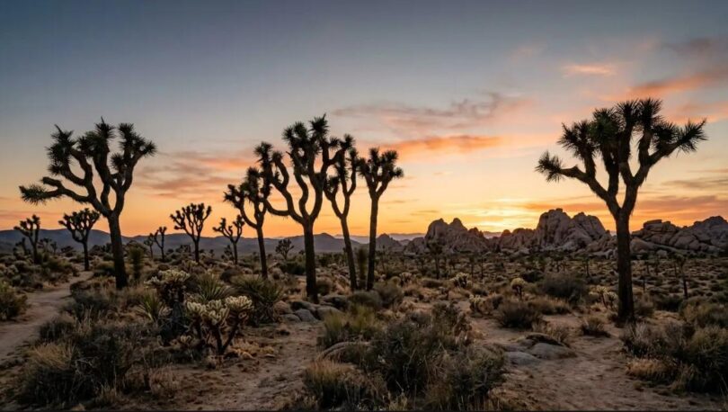

Joshua Tree sits at the meeting point of two deserts, the Mojave and the Colorado. That geography shapes everything about a visit, from the plants you see to the way the light behaves at sunset.
This guide covers the neighborhoods travelers usually consider, realistic driving times between key spots, and the small details that make a first trip go smoothly. It is written for people planning a few days on the ground, not a quick pass-through.
The Neighborhoods Around the Park
The town of Joshua Tree is the closest hub to the West Entrance. It has grocery stores, a farmers market on Saturdays, and a walkable stretch of cafes and shops along Highway 62. Most visitors use it as their base for the park.
Yucca Valley, about ten minutes west, offers a wider grid of streets and larger stores. Prices tend to be lower and homes are often set on bigger lots. Travelers who want more space and less foot traffic often look at rental homes near Joshua Tree in this area.
Twentynine Palms lies to the east and puts you close to the park’s less-visited North Entrance. It has a quieter feel, a strong military-town presence from the nearby base, and murals scattered across the downtown.
Pioneertown is a small enclave north of Yucca Valley. Originally built as a movie set in the 1940s, it has a working saloon, a music venue, and desert homes tucked into the boulders above it.
Getting Around: Realistic Driving Times
The drive from Palm Springs International Airport to the town of Joshua Tree takes about an hour without traffic. Going through Yucca Valley adds only a few minutes.
Inside the park, plan on slow speeds. The main road from the West to the North Entrance runs roughly 45 miles but takes about 90 minutes if you stop at a couple of turnouts. Cholla Cactus Garden and Keys View both reward the detour.
Day Trips Worth the Miles
Salton Sea sits about 90 minutes south and pairs well with a stop at Salvation Mountain. Palm Springs is 45 minutes for a swim and a proper dinner. Big Bear is a longer haul, two and a half hours, but the elevation change is dramatic.
What to Pack for the Desert
Layers matter more than heavy jackets. Daytime temperatures in spring and fall run in the seventies, then drop into the forties overnight. A fleece and a windbreaker cover most conditions.
Water is the other essential. Rangers recommend one gallon per person per day if you plan to hike. There are no drinking water sources inside the park past the entrance stations.
Cell service inside the park is limited and inconsistent. Download offline maps before you leave your accommodation. A paper park map from the visitor center is worth grabbing as backup.
When to Visit
October through April is the popular window. Temperatures are comfortable and the wildflowers can bloom as early as February in a wet year.
Summer is genuinely hot, with July averages above 100 degrees. Some travelers still enjoy it for the quiet and the star viewing, but hikes should be early morning only.
Practical Tips Before You Go
Book park entrance times ahead during holiday weekends. The West Entrance line can stretch for an hour on peak Saturdays, and reserving a timed entry saves the wait.
Groceries are limited inside the park itself, so stock up in Yucca Valley or the town of Joshua Tree before heading in. A simple picnic on a boulder often becomes the highlight of a day.